Village History
North Rigton History
North Rigton lies on the south facing slope of a sandstone ridge over 150m high, running from east to west in the valley of the River Wharfe.
The earliest settlers here are thought to have been Anglo Saxon farmers who arrived between 500 and 600AD. They found the ridge covered in bushes, with the lower slopes stretching down to the river densely wooded. The sandstone here was covered with clay deposited by the melting glaciers at the end of the last ice age. They removed some of the bushes to create a settlement high up on the ridge, realising that the clay soils lower down would give fertile land for their crops when they too had been cleared. The southerly aspect of the slope was sunny and well-drained, and water was available from nearby springs.
The Anglo Saxons in the late 7th century and earlier cleared some forest up from the River Wharf, and created settlements, these place names often ended in ‘TON’ and so we have Weeton, Rigton and Arthington. Clearings provided arable land for cultivation, timber, crop growing and sheep grazing.
From then on farming communities have shaped the landscape. Today farming helps maintain the environment as well as providing local meat, milk and crops. Without them this beautiful area would look very different.
The village is mentioned in the Domesday book and was still a forest in 1082 and a royal hunting area at that time. The settlement was acquired by the de Mowbray family soon after the Conquest and they - generous benefactors of the north’s religious houses - donated substantial holdings at Rigton to Fountains Abbey. This gift was confirmed in a charter of 1280.
Following the dissolution of the monasteries in 1538, the Fountains Abbey lands at Rigton were bought by Sir William Fairfax of Denton, Otley, forebear of the Parliamentary general Sit Thomas Fairfax. The Fairfaxes sold to Robert Wilkes whose granddaughter sold the estate in 1796 to the Earl of Harewood.
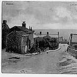
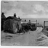
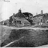
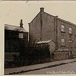
The enclosure map of 1779 shows that the village was linear in shape alongside a road which was formerly called Chapel Hill and is now Rigton Hill. The road divided at the top of the hill. The existing green area, Common land, was a “pound”, a cattle enclosure for stray stock. This is where the original stocks were located. A manor house stood at the eastern end of the village near to where Hall Green Farm stands today, the moat can still be seen in the field behind the primary school.
More recent links to Harewood
The present-day Harewood Estate, which includes the stately house and its grounds north of Leeds, once extended far beyond, and took in the villages of Rigton, Weeton, Dunkeswick, Kirkby Overblow and parts of Pannal on the road out to Harrogate. The outer estate comprised farmland, much of it tenanted out to smallholders whose families had worked it for generations.
The death in 1947 of Henry Lascelles, sixth Earl of Harewood, who married Princess Mary, daughter of George V is thought to have forced the family into a wholesale sell-off. Death duties of up to 80 per cent had been imposed by the post-war Labour government and the aristocracy was hit hard. Property was sold off to settle the bills and many stately homes demolished to avoid being liable for probate duty.
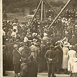
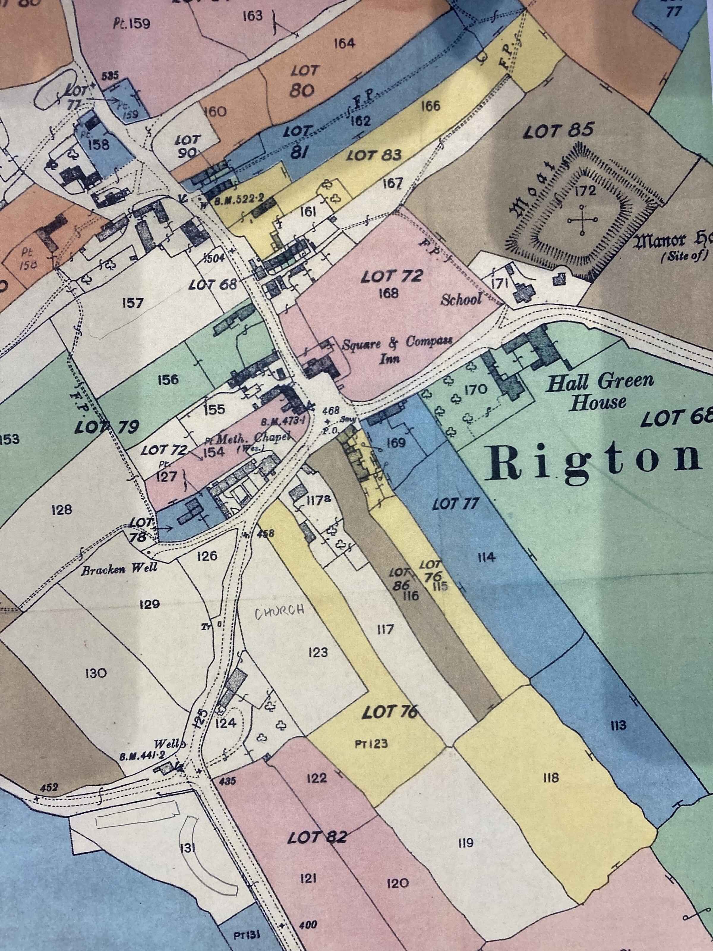
The Harewood estate sold most of the farms and properties still in its ownership in 1951. It was possibly one of the biggest property transactions of its time, thousands of acres of farmland went under the hammer – its disposal deemed crucial to keeping the main house and park intact. The eventual sale, in 1950, disposed of 99 lots, covering some 7,600 acres, and raised £256,000 – more than £9m at today’s prices. The average price of an acre at the time of the sale was just £50.
(The attached image shows the patchwork of plots sold in North Rigton.)
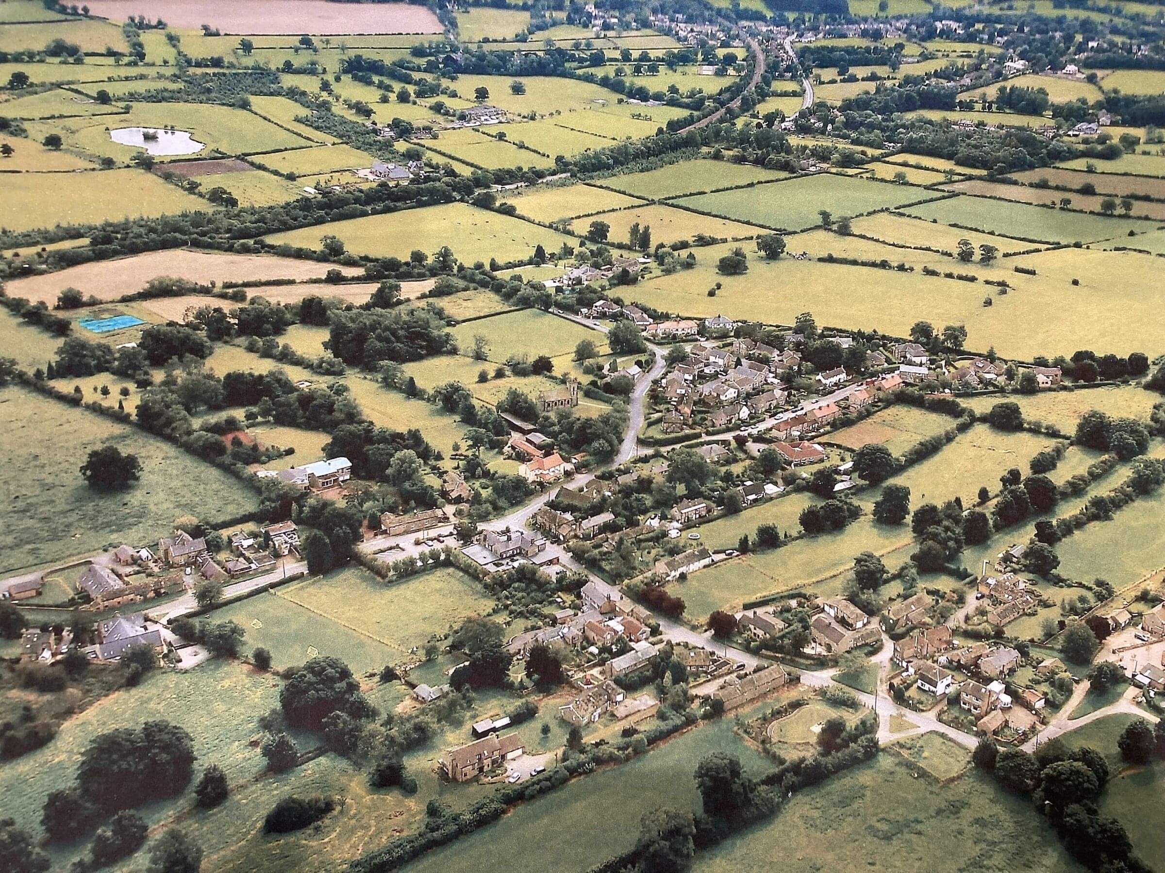
The village in the 21st century
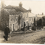
The village has undergone many changes. There are no longer any thatched properties and many of the old buildings have been demolished and replaced by more modern ones or drastically altered. The few surviving signs of these long-lost times are the stocks and the moat.
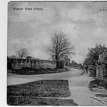
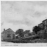
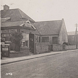
In spite of the increase in size the village has lost some of its services; the Chapel has closed and is now an exercise studio, the shop/post office has gone, and a bus service no longer comes to the village. Many of the old buildings have been removed or converted and enlarged. There is still a thriving farming community however most residents now work in nearby towns and cities.
Briscoe Wood
Briscoe Wood is located at the cross roads to the west out of the village towards Beckwithshaw. It is one of 20 new woods created for the millenium celebrations.
Residents of the village were invited to help with the planting of the 16 acres of woodland which consists of native broad leaf trees and shrubs which naturally occur in the area. It is open to the public and has a walkway around the site with a seat from which you can gain an uninterrupted view of Almscliffe Cragg and the Wharfe Valley.
Red Tail Kites
Twenty one young red kites were released into the wild on the Harewood Estate in summer 1999 as part of a reintroduction programme and now the Estate is one of the top British sites to see the birds of prey.
Kites can be spotted at close range around the village and Almscliffe Cragg and are now frequent visitors. Breeding pairs are now in the village.
Send us a message
Clerk: Mr Michael Richards
Chairman: Councillor Mary Hopkins
Vice Chairman: Councillor Barbara Massey